
Perry Neighbors Across Public Records
A block lookup combines sources because each record answers a different question. The parcel map defines which lots border the subject. The assessment card identifies the owner and mailing destination. A lawful voter list can show registered adults at residence addresses, while permits and public civic records show activity rather than household membership. Perry has no verified public citywide HOA directory, so private association, congregation, and block-watch rosters remain outside the search.
| Source | What It Shows About a Block | Access |
|---|---|---|
| Houston qPublic and GIS | Adjacent taxable parcels, owners, situs, mailing, and parcel keys | Free map and parcel cards |
| Georgia voter file | Registered adults by residence street, unit, ZIP, precinct, and district | Paid SOS order with restricted use |
| Perry permit and code files | Projects, applicants, contractors, dates, inspections, and public case data | Portal or Open Records Act request |
| Historic district records | Surveyed resources, photos, district boundaries, meetings, and public contacts | City Historic Preservation Commission |
| Older city directories | Listed occupants or businesses by house number if a reverse section exists | Golden Local History Room; exact holdings unverified |
Ownership and occupancy are not synonyms. An owner's mailing address may be a post office box, business, trustee, or other destination. A matching mailing and situs address, plus a current homestead indication, can support an owner-occupancy inference, but it still does not name the full household. Perry neighbors who rent will usually be absent from the parcel roll.
Define the Perry Block First
Decide what “neighbor” means before collecting names. One useful scope is every parcel sharing a boundary with the subject parcel. Another includes lots across the street, across a rear line, or on the nearest corner. Write the rule down and apply it evenly. Otherwise a large tract or a corner parcel can distort the result.
Perry's postal label does not settle jurisdiction. Municipal limits reach the Houston-Peach county line at the northwest edge, and a Perry mailing city may cover land outside a simple city assumption. Confirm the parcel polygon and county before naming an assessor or records custodian. The qPublic link used here is for Houston County parcels.
Map Perry Neighbors by Parcel
The Houston County qPublic map is the practical address-to-block route. A parcel is one tract carried on the tax roll. Its situs address is the physical location, while its mailing address is where assessment mail goes. The legal description and parcel number are the safer keys when street forms differ.
- Search the exact address, open the parcel card, and confirm the map polygon.
- Zoom until roads and lot lines are clear. Click every polygon that meets the chosen block rule.
- For each card, record the parcel ID, situs, owner, mailing address, exemption field, and valuation year.
- Check corner and rear lots whose situs may use another street. Mark every inference about occupancy.
No Houston-specific radius or buffer tool was verified during research. Use direct parcel clicks rather than claiming that the map generates a neighbor radius. For every parcel along the named road, use the Perry Street Directory workflow instead.
Perry Owners Are Not Households
The assessor establishes taxable ownership and value. The Tax Commissioner separately bills and records payment. Neither office maintains a complete roll of Perry neighbors who occupy each dwelling. A property card can show a current owner, mailing and situs addresses, parcel number, legal description, values, improvements, sales history, and an exemption field. Those facts describe the tax parcel.
Use a homestead indication only as a clue that an owner may occupy the parcel. Do not infer renters, relatives, guests, or relationships from the owner's name. Shared surnames and nearby mailing addresses also prove little without a second official record.
Record test. Ask whether the field identifies land, an owner, a mailing recipient, an applicant, or a resident. Keep those roles separate.
Perry Neighbors in Voter Data
Georgia My Voter Page is an authenticated self-lookup. It uses a voter's first initial, last name, county, and date of birth to return that person's registration, precinct, districts, sample ballot, and participation information. It does not browse a Perry block.
Block-level voter research requires a purchased Georgia elector file under O.C.G.A. §21-2-601. A county file currently costs $70, while a municipal file costs $65. It can include residence street, apartment, city, state, ZIP, county, precinct, districts, status, and participation fields. Commercial use is barred. Ballot choices are never disclosed.
The file still cannot answer who all the neighbors are. It omits people who are not registered, and an inactive status is not proof of a move. VoteSafe protects qualifying voter addresses. A narrow request to Houston County Elections by precinct or district may help with public election records, but MVP remains personal rather than a street tool.
Perry Neighborhoods Through Civic Records
Perry's verified community layer is built from public contacts, not member lists. The Historic Preservation Commission publishes material for Washington-Evergreen, Swift Street, Downtown, and Oldfield. The city also maintains district maps, agendas, minutes, and public-comment records that connect a block to its elected representative and civic issues.
Historic Preservation Commission
District boundaries, designation records, surveys, photos, agendas, and public contacts for Perry historic areas.
Perry City Clerk
Council minutes, appointed boards, city correspondence, and defined open-records requests at 808 Carroll Street.
Golden Local History Room
Historical directories, newspapers, yearbooks, family history, and staff-assisted local research at the Perry library.
No authoritative Perry umbrella list of neighborhood associations or public HOA membership rosters was found. Use a group's published officer or contact address only. Treat HOA members, congregation lists, and block-watch rosters as private unless the group itself makes them public.
Perry Blocks in Historic Surveys
Perry's updated historic repository offers an unusually rich block context. Its five-volume survey covers roughly 250 resources, and Swift Street material was updated in 2025. A survey may describe a structure's date, style, condition, photo, district role, or past use. It is not a resident roll.
These records work best after parcel mapping. Match the survey address and image to the current parcel, then compare directory, deed, census, and newspaper dates. In Oldfield or the named historic districts, that extra layer can explain why nearby parcels differ in size, use, or street relationship without making unsupported claims about current neighbors.
Perry Permits Show Block Activity
Perry Community Development records can show building, sign, site-plan, subdivision, zoning, variance, annexation, and historic-district work by address. Citizens Self Service offers public search by address, parcel, or record number. Older or unposted files can be requested by email, at 741 Main Street, or through the City Clerk's open-records channel.
A result may include the owner, applicant, contractor, work description, dates, status, and inspections. It proves a public filing or project event, not the applicant's residence and not a relationship among neighbors. Code files may also require redaction. Ask for a defined address and date range rather than “everything” about a person, since Georgia law does not require a new compilation.
Perry Block Records by Request
Online search is only one access channel. Perry City Clerk Annie Warren is the designated city records custodian at 808 Carroll Street, 478-988-2736. The city accepts a web form, email at cityclerk@perry-ga.gov, and in-person requests. Ask for an existing permit, council item, map, complaint case, or correspondence by address, record number, and date range. A narrow description helps staff locate the source without creating a new block directory.
The Georgia Open Records Act generally requires production within three business days or a written response stating the schedule, estimated cost, and exact legal basis for withholding. Search and redaction labor uses the lowest-paid qualified employee, with the first fifteen minutes free. Ask for native electronic copies where practical and set a cost ceiling. Protected fields should be redacted from an otherwise public record.
County-held parcel and election questions go to the proper Houston County office, not City Hall. The assessor can explain a parcel card or nondisclosure request. Elections can address a lawful voter-list order. Historic directories and newspapers are best handled through the Golden Local History Room. These phone, counter, email, library, and written-request routes matter when a dynamic portal fails or an older Perry record was never posted.
Note: An agency must provide existing records, but Georgia law does not require it to compile a new list of all people on a block.
Official Perry Records or Aggregates
Commercial neighbor tools merge public and licensed data. They can lag changes and blend people with the same name. Official sources are narrower, but each field has a named custodian and a clear date.
| Source Type | Useful For | Main Limit |
|---|---|---|
| Official parcel and permit records | Owners, land identity, and dated public activity | Not a household directory |
| Lawful voter file | Registered adults and election geography | Paid, restricted, incomplete, protected addresses removed |
| Commercial compiled data | Possible leads to verify elsewhere | May be stale, merged, or hard to date |
When data is wrong, correct the custodian's source record first. Downstream copies may then refresh. Georgia has no verified universal consumer-data deletion right, so do not promise one.
Protected Perry Neighbor Addresses
Georgia VoteSafe shields the residence address of eligible registered voters who meet protective-order or family-violence shelter criteria. Redactions also protect sensitive identifiers and specified personal data. Public access is never a way around a confidentiality program.
Review the Georgia VoteSafe information linked before the captured page below.
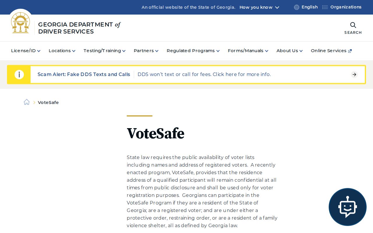
The program explains why a lawful public voter file may omit an address that other dated sources once showed.
Privacy Limits for Perry Neighbors
Utility accounts, private delivery records, DMV addresses, private rosters, sealed matters, and protected voter addresses do not become public merely because someone wants a complete block list. Georgia's Open Records Act requires protected fields to be redacted, not exposed. Property data omits most renters and household members by design.
Use public records for civic curiosity, a property question, reconnecting, or personal safety awareness. If a record seems inconsistent, check its date and address type, then contact the custodian. Do not fill a gap by guessing who lives there.
Lawful use. Never use Perry neighbor records to watch, intimidate, stalk, threaten, or harass any person. Public availability does not permit abuse.