
Perry ZIP Code Coverage
Official postal evidence supports two delivery areas administered by the Perry Administrative Post Office, but only one is Perry's principal postal area. The February 2025 USPS Office of Inspector General audit describes service for 31069 and Kathleen 31047. It does not redefine Kathleen as Perry or draw Perry's city boundary.
| ZIP | Verified area or function | Post office | Important note |
|---|---|---|---|
| 31069 | Perry preferred postal area and principal delivery ZIP | Perry Post Office, 1400 Macon Road | Includes city addresses and territory beyond a simple city-line assumption |
| 31047 | Kathleen delivery area administered by Perry APO | Kathleen delivery service under Perry APO | Not a second Perry city ZIP |
The Perry Post Office telephone number is 478-988-1251. Published retail hours are 8:30 a.m. to 5 p.m. weekdays and 9 a.m. to noon Saturday, while PO-box access is available around the clock. USPS also lists nearby facilities for Clinchfield, Kathleen, and Elko. Nearness does not make those postal places part of Perry.
The ZIP code directory therefore records function as carefully as number. A delivery label is useful for mail. It is not proof that Perry City Hall governs an address or that Houston County holds its parcel file.
Perry APO Serves Two Areas
The USPS OIG audit of Perry delivery operations is the strongest current official description of the combined service area. It reports about 39,840 people served across 31047 and 31069, with 31,205, or 78 percent, in urban territory and 8,635, or 22 percent, in rural territory.
View the official Perry Administrative Post Office audit page.
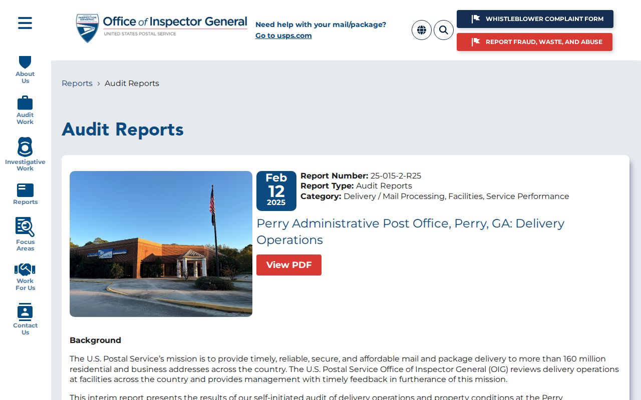
The image documents the postal operation behind both service areas. Those figures describe delivery administration, not the population of the City of Perry and not a resident count for 31069 alone.
This geography is easy to misread. Kathleen 31047 remains a Kathleen delivery area even though the Perry office administers it. A ZIP code directory should keep the postal name, municipal government, and record custodian in separate columns.
Finding Perry Residents by ZIP
ZIP-wide resident searching is limited. USPS confirms the delivery label. The voter file includes residence and mailing ZIP fields, but My Voter Page does not provide a ZIP browse. Houston qPublic may display a ZIP within an address result, yet the research did not verify a public ZIP filter. Use the ZIP as a narrowing field, not as a complete list of people.
- Verify the city-and-state mailing label with the USPS ZIP Code Lookup.
- Open the Houston or Peach parcel map and locate the exact address. Record its parcel number, situs address, and county.
- Compare the parcel with Perry's city-limits map to establish whether it falls inside the municipality.
- For voter research permitted by Georgia law, obtain the proper elector file and filter Residence ZIP, not the authenticated My Voter Page form.
- Once a ZIP narrows the area, use the Perry Street Directory to work by exact street and address.
Professional-license bulk rosters include city, state, ZIP, county, license number, status, and dates, but they cannot be ordered as a Perry-only subset. They cover a credentialed group, not every resident. No verified Houston assessor ZIP-filter mode was found, so do not promise one.
Perry Limits Cross Counties
The Perry ZIP code directory cannot settle county jurisdiction. Perry publishes a city-limits map, and its zoning and council maps show that the municipal boundary reaches the Houston-Peach county line. Peach County's tax material lists City of Perry as District 04, confirming a northwestern municipal area within Peach County. Most Perry records are in Houston County, but an edge parcel may belong at the Peach assessor or clerk.
Use the official Perry city overview and map route together with the county parcel map. The parcel polygon answers where the land sits. The city map answers whether Perry governs it. USPS answers how mail is routed. These are related but distinct tests.
Boundary check. Never assign a Perry mailing address to Houston County without checking the parcel, especially near the northwestern edge of the city.
A Peach County parcel inside Perry still uses city services and rules where applicable, while county-held land records follow the county. When the map is unclear, ask Perry Planning or the relevant county GIS or E911 office to confirm the assigned address.
Three Perry Address Types
One address can appear in several forms because each system serves a different purpose. The ZIP code directory handles delivery geography, while property and land records depend on physical location and legal identity.
- Situs address
- The physical location used by the assessor and permit office. It is the best plain-language key for a parcel.
- Mailing address
- The postal destination used for owner or voter correspondence. It may differ from the physical site.
- Legal description
- The land identity stated through land lot and district, subdivision lot and block, plat, or metes and bounds.
- Parcel number
- The stable local database key that connects the map and assessment record even when street wording changes.
A ZIP tool validates delivery, not ownership. A legal description bridges old deeds and plats when a road name or street number is not enough. For annexed land, the parcel number also helps prevent a postal label from sending the request to the wrong office.
Perry ZIP Terms Explained
Postal terms can sound more precise than they are. A base ZIP groups delivery geography, while added digits and carrier routes make sorting more exact. Neither replaces parcel or city-limit data.
- ZIP Code
- A five-digit postal delivery area. It does not have to match a city, county, or voting boundary.
- ZIP+4
- The five-digit ZIP plus four digits that identify a smaller delivery segment, such as one side of a block or a building group.
- PO-box ZIP
- A ZIP assigned chiefly to post-office boxes. No Perry-only example was verified in the research.
- Unique ZIP
- A ZIP assigned to one high-volume institution. No unique Perry ZIP was verified.
- Carrier route
- The group of addresses served by one mail-delivery route, which can cut across other civic boundaries.
No authoritative Perry ZIP realignment date, unique institutional ZIP, PO-box-only ZIP, or neighborhood-by-ZIP population table was found. Those gaps matter. They prevent a precise-looking but unsupported map from entering the directory.
Perry Growth Shifts Record Lines
Perry grew from 20,624 residents in the 2020 census to an estimated 25,699 in 2025, a 24.8 percent rise from the revised base. New subdivisions and annexations can change which municipal desk serves an address even when the postal wording stays the same. A five-year-old resident list or parcel export may already be stale.
The city's new standalone 20-year comprehensive plan responds to that expansion. In July 2026, Perry launched another phase of public input. The planning work focuses on future growth and service needs, so it also signals why the ZIP code directory must distinguish a fixed mail label from changing city governance.
Read Perry's comprehensive-plan update.

The plan update provides current context for annexation and service expansion. It does not replace the parcel map or USPS lookup for a specific address.
Historic Perry Address Geography
Older records cluster differently from recent ones. Downtown took its present shape in the 1910s and 1920s along Carroll Street between Ball and Washington. Perry Parkway developed in the 1990s and early 2000s, while repeated annexations pushed services outward. Central addresses may appear in older directories, censuses, newspapers, deeds, and preservation surveys. Edge subdivisions are more likely to depend on recent plats, permits, and parcel records.
The Perry Historic Preservation Commission repository adds maps, photographs, designation files, and a multi-volume survey for about 250 resources. Its Washington-Evergreen, Swift Street, Downtown, and Oldfield context helps connect an old address with a real place.
Open Perry's historic preservation records.
The repository is useful when modern ZIP geography does not explain an older street reference. No citywide Perry street-renumbering event was verified, so compare old maps and source dates instead of assuming one.
Checking Perry Postal Boundaries
Finish with the authority for each fact. USPS establishes the correct delivery city and ZIP. Houston or Peach GIS establishes the parcel and county. Perry's city map establishes municipal status. Planning and E911 staff can resolve uncertain assigned addresses. A lawful voter file can be filtered by Residence ZIP, but it does not show unregistered people, children, every household member, or a protected address.
The ZIP code directory is strongest as a routing tool. It tells a researcher where to check next, not who lives inside every delivery polygon. If a portal does not expose the needed field, Georgia's Open Records Act allows a narrow request to the actual custodian. The office need not create a new compilation, so ask for an existing record, date range, address, parcel, or defined export.
Postal and civic borders will keep changing at different speeds. Save the date of every map and result. That small step prevents a current ZIP code from being read back into an older deed, directory entry, or resident record.